Skip to content
Home  >  
February 20, 2012

On Scene Preplans

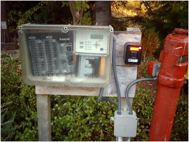
One clever ways view information about an occupancy is to have all of you information in one location.  We saw this in Tumwater, Washington where all of the “critical information” was available in one spot for responding fire companies.  There was location outside the collapse zone (I’m not sure if…..

Categories Preplan Tips

RSS Mapping Tech Podcasts

  • Oregon Emergency Management
  • What could we have done differently?
  • Public Safety Communications Research 2020 Conference Review
  • ESRI GIS User Conference - Finale Wrap Up
  • ESRI GIS User Conference - Day 3 Wrap Up
  • ESRI GIS User Conference - Day 2 Wrap Up
  • ESRI GIS User Conference - Day 1 Wrap Up
  • Play the Long Game - Houston PD GIS
  • Mapping Tech in Public Safety - GIS Corps
  • Mapping Tech in Public Safety - Still at Home

Admin

  • Log in
  • Entries feed
  • Comments feed
  • WordPress.org

©2025 Mapping Technology in Public Safety

  • Youtube
  • Slack
Back To Top