Introductions

This blog will discuss how Geographic Information Systems (GIS) can be a valuable tool in Public Safety. The Mapping Tech in Public Safety Blog will also be a companion to the podcast of the same name. The purpose of this blog is to introduce non-technical information about GIS
and the benefits for Public Safety Agencies. Information from the podcast can be found on this blog along with links to GIS website resources.
What is GIS?
ESRI – a leading GIS software company used by many GIS professionals defines GIS as a framework for gathering,
managing, and analyzing data. Rooted in the science of geography, GIS integrates many types of data. It analyzes spatial location and organizes layers of information intovisualizations using maps and 3D scenes. With this unique capability, GIS reveals deeper insights into data, such as patterns, relationships, and situations – helping users make smarter decisions.
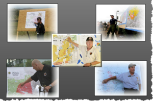
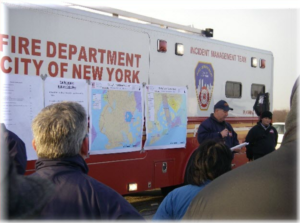
No matter what area of Public Safety, GIS can be useful. GIS can be used during major operations, pre-planning, various daily operations, incident type analysis, disaster preparedness, support for Operation Centers, and Public Safety Answering Points (PSAP).
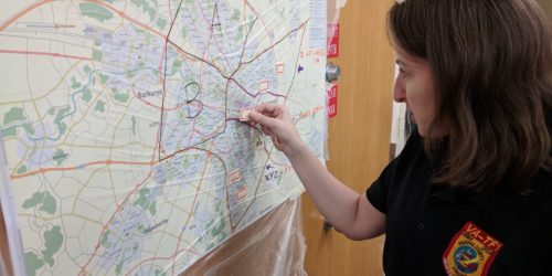
Many Public Safety personnel have never heard of GIS or have just seen maps during an incident. Even if you don’t plan on becoming a GIS professional, the material discussed can provide an understanding of uses for GIS to provide Public Safety Professionals with the knowledge to be able to approach a GIS professional to request maps for their purpose. GIS has the ability to analyze data and visually present that data. Meaning a map user can ask questions about information and receive visual answers on a map.
-
What infrastructure can potentially be affected during a Hurricane Storm surge?
-
Where are the closest shelters for residents during a mandatory evacuation?
-
What are the hot, warm and cold zones during a Hazardous Material incident?
-
Identify areas that have been completed, in-progress or not started during a Search and Rescue.
-
What electrical power grids are off-line during a natural disaster, man-made disaster or black-out?
-
Does our fire department meet the NFPA standards for response times? If not, what are the areas that are not adequately covered?
-
What residential areas are threatened from a wildfire?
These are the samples of visualizations that can be seen utilizing GIS in Public Safety. While Chris and I both have a background in the Fire Service and Emergency Medical Service (EMS), there are many fields of Public Safety that GIS is useful. Our plan is to discuss our experience and to also discuss GIS applications for other areas of Public Safety with experts in those fields. As mentioned, podcast and blog materials are meant to be non-technical but we may discuss various mobile apps, Web Map applications and desktop software to explain how GIS can be utilized. Many Web Maps and mobile apps are made to be simplified to visual, collect and edit GIS data for field personnel. We will also try to interview guest from software companies to demonstrate options that agencies can use but we do not promote any specific software company.