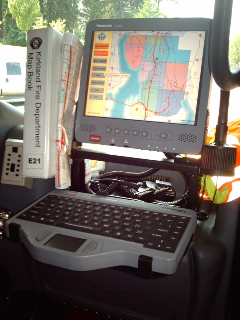
Mobile Mapping Software
This post is an updated July 2021.
I get a lot of questions about in vehicle mapping and what is the best solution. I have evaluated several products and I can tell you that all of them are good products. First of all I’ll tell you my bias, the best option for mapping software is software created in a recognized GIS software.
GIS Based Applications

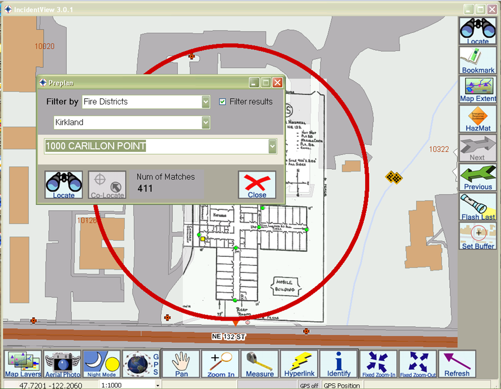
Some of the most common applications still use MapObjects (the code base from ESRI that was created over 25 years ago and is no longer supported). More commonly mapping applications use ArcObjects or ArcGIS Runtime which are also created by ESRI. There are application based on other mapping applications including MapInfo or Integraph, but the dominate applications are ones created by ESRI. Many Computer Aided Dispatch (CAD) companies offer applications that tend to be based on MapObjects with migrations to ArcObjects. Newer applications are using ArcGIS Runtime.

As of 2021, there are several ESRI based web or ArcGIS Runtime applications that don’t require connections to CAD but work with CAD. Most aren’t necessarily navigation programs but are applications related to other tasks. For example, Intterra is a browser based application with multiple uses such as analytics and incident management. First Due Sizeup is an application both in app and browser form with a focus on pre-incident planning. Tablet Command is an app (IOS only) based application focused on fire department incident command. All of these applications have an ESRI platform or have a hybrid approach with Google Maps.
Non GIS Applications
There are other applications that use as there building blocks Google Maps or a similar application with canned data. These are great applications since they tend to be fast and the data is already available. There are a couple of major problems
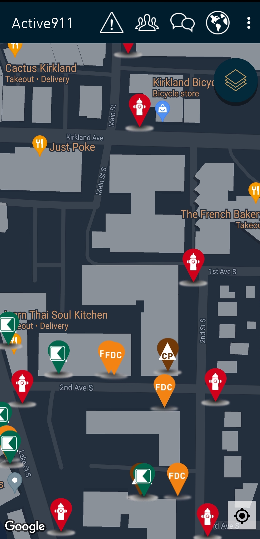
- The base data is only updateable when Google updates their information
- There isn’t an ability to add other information such as hydrant data directly.
- ArcObjects and MapObjects are older building blocks that the majority of mobile mapping applications are written in.
- ArcGIS Runtime and web based mapping are newer building block for GIS software. The abilities are much more robust with the notable exception of routing in the same for as in ArcObjects. I understand that this is being remedied.
This is my thinking in a nutshell. Give a shout if you have any questions.